The basic premise of this blog is that cities and urbanism have been around for thousands of years, and that it is interesting and useful to take a broad perspective on these things. The "Wide Urban World" is the realm of cities from ancient Mesopotamia to the present. Consideration of premodern cities can provide insights into modern urban issues, and research on contemporary cities can help historians and archaeologists understand past cities. And consideration of both modern and past cities will allow us to understand the nature and variation of urbanism much more fully than a narrow focus on a single time period or place. Beyond this blog, my colleagues and I have made this point in a number of publications (see the list at the bottom).
There is an alternative understanding of the meaning of the term "urban," however, that is much more narrowly conceived. To some, "urban issues" are issues of contemporary cities (and perhaps their predecessors over a century or so). Either past cities did not have "urban issues," or else their "urban issues" are irrelevant to modern concerns, not worth considering. This is the viewpoint of the well-known policy institution, the Urban Institute, which features "nonpartisan economic and social policy research." This kind of "present-only" perspective on urbanism can be called "presentism." For critiques, see any of the papers below (particulalry Harris & Smith 2011).
Now there is another presentist institution, the new "Urban Portal" of the University of Chicago, billed as "a gateway to the latest in urban social science." I looked around the site and its resources, and much of it looks interesting and important. But I found no explicit acknowledgement that history or comparison are considered important for urban social science. Well, that is certainly not my view of the topic. Let me re-write their "about" section in a more accurate manner:
"The Urban Portal is an online hub designed to provide experts and
non-experts easy access to current research and resources on CONTEMPORARY urban
issues IN THE UNITED STATES. The Portal is a core project of the University of Chicago Urban Network,
an emerging community of scholars and others that aims to spur
innovation in the study of MODERN urban processes and to encourage
interdisciplinary discourse in urban research, theory, and policy THAT EXCLUDES HISTORICAL OR COMPARATIVE PERSPECTIVES."
If you'd like to see a more formal scholarly argument for the kind of broad approach to urban studies I advocate, look at this White Paper some of us submitted to the program "Future Research in the Social, Behavioral and Economic Sciences" at the National Science Foundation, or look around our website.
REFERENCES:
Briggs, Xavier de Souza
2004 Civilization in Color: The Multicultural City in Three Millennia. City and Community 3:311-342.
Fletcher, Roland
2009 Low-Density, Agrarian-Based Urbanism: A Comparative View. Insights (University of Durham) 2:article 4.
Grant, Jill
2001 The Dark Side of the Grid: Power and Urban Design. Planning Perspectives 16:219-241.
2004 Sustainable Urbanism in Historical Perspective. In Towards Sustainable Cities: East Asian, North American and European Perspectives on Managing Urban Regions, edited by André Sorensen, Peter J. Marcutullio, and Jill Grant, pp. 24-37. Ashgate, Burlington, VT.
Hakim, Besim S.
2007 Generative Processes for Revitalizing Historic Towns or Heritage Districts. Urban Design International 12:87-99.
Harris, Richard and Michael E. Smith
2011 The History in Urban Studies: A Comment. Journal of Urban Affairs 33(1):99-105.
Smith, Michael E.
2009 Editorial: Just How Comparative is Comparative Urban Geography?: A Perspective from Archaeology. Urban Geography 30:113-117.
2010 Sprawl, Squatters, and Sustainable Cities: Can Archaeological Data Shed Light on Modern Urban Issues? Cambridge Archaeological Journal 20:229-253.
York, Abigail, Michael E. Smith, Benjamin Stanley, Barbara L. Stark, Juliana Novic, Sharon L. Harlan, George L. Cowgill, and Christopher Boone
2011 Ethnic and Class-Based Clustering Through the Ages: A Transdisciplinary Approach to Urban Social Patterns. Urban Studies 48(11):2399-2415.
Thursday, October 27, 2011
Monday, October 24, 2011
Urban Planning in Ancient Central Mexico
![]() |
1. Plaza at Dos Pilas, Maya city |
![]() |
2. Tikal |
1. The Basic Mesoamerican Urban Plan
![]() |
3. Yagul |
![]() |
5. Teotihuacan |
![]() |
4. Teotihuacan (1950s) |
![]() |
7. Tula |
![]() |
6. Downtown Tula |
4. Aztec City-State Capitals: Keeping the Toltec Ideals Alive
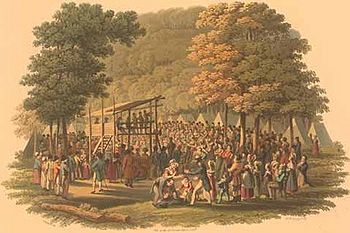
![]() |
8. Coatetelco |
![]() |
9. Coatetelco, ballcourt |
After the fall of Tula, the Aztecs arrived on the scene. The Early Aztec period (AD 1100-1300) was a dynamic time of population growth and the expansion of city-states across the landscape. Kings established dynasties, and they claimed descent from the Toltec kings as the basis of their legitimacy. To the Aztecs, the Toltecs were the wise, great, and wonderful ancestors. So it is hardly surprising that these petty kings, who ruled small city-states, copied their cities after Tula as one way of claiming Toltec descent. Compare the plan of Coatetelco (fig. 8) to that of Tula: they are almost identical (except that Tula is much larger than Coatetelco!). The architecture and layout of these Aztec city-state capitals were political statements by the Aztec kings, proclaiming not only their power and glory, but their links to the Toltec past (this is one of the main arguments of my book, Aztec City-State Capitals).
5. Tenochtitlan, the Imperial Capital: Back to Teotihuacan and the Toltecs
![]() |
10. Tenochtitlan |
![]() |
11. Tenochtitlan |
This story has several lessons. First, looking at ancient city plans can be very informative. They give us insights into political and social processes from hundred, or even thousands of years ago. Second, urbanism and planning were highly dynamic processes. There was no "standard" pattern of central Mexican capital city. City plans, forms, and significance changed over time, and careful analysis, city-by-city and period-by-period, is needed to tease out these changes. Third, even though we cannot name the planners and architects responsible for these cities, we can reconstruct something of their context and aspirations. Many of their urban creations lasted for centuries (in some cases, far longer than most modern cities have survived so far), and left impressive marks on the landscape.
Read about these ancient cities and visit their ruins in Mexico. They are an important part of the Wide Urban World.
References:
Andrews, George F.
1975 Maya Cities: Placemaking and Urbanization. University of Oklahoma Press, Norman.
Calnek, Edward E.
2003 Tenochtitlan-Tlatelolco: The Natural History of a City / Tenochtitlan-Tlatelolco: La Historia Natural de una Ciudad. In El urbanismo en mesoamérica / Urbanism in Mesoamerica, edited by William T. Sanders, Alba Guadalupe Mastache, and Robert H. Cobean, pp. 149-202. Proyecto Urbanismo dn Mesoamérica / The Mesoamerican Urbanism Project, vol. 1. Pennsylvania State University and Instituto Nacional de Antropología e Historia, University Park and Mexico City.
Cowgill, George L.
1997 State and Society at Teotihuacan, Mexico. Annual Review of Anthropology 26:129-161.
Diehl, Richard A.
1983 Tula: The Toltec Capital of Ancient Mexico. Thames and Hudson, New York.
Smith, Michael E.
2007 Form and Meaning in the Earliest Cities: A New Approach to Ancient Urban Planning. Journal of Planning History 6(1):3-47.
Smith, Michael E.
2008 Aztec City-State Capitals. University Press of Florida, Gainesville.
Monday, October 10, 2011
Dense living
![]() | |
Dense living |
"Dense Living: Most of the worlds population will live in cities. Let's look at this trend and its consequences.”
Here are a few of the entries:
- Dense designs
- Is new urbanism sustainable?
- Theory of evolution links cities, science, fractal geometry
- Urban sprawl around Istanbul
- Did ancient cities have urban sprawl? (sound familiar? it should).
- Paolo Soleri: a vision of dense, liveable cities
Check out "Dense living" for some interesting news and stories.
Thursday, September 29, 2011
Round Lake: From Methodist Camp Meeting to Modern Village
The village of Round Lake is located in Saratoga County, NY, between Albany and
Saratoga Springs. It stands out in upstate New York for its unusual layout and
architecture. I used to live in Saratoga County, and I was always intrigued
when I drove through Round Lake. The village consists largely of houses in Victorian
style (gingerbread molding, steep gables, front porches, etc.), but many are
small cottages, far smaller than most Victorian style houses in the U.S. The
houses are located very close together, but with parks and open spaces
throughout the settlement. The streets are narrow and laid out in a generally
concentric wagon-wheel arrangement around a large wooden assembly hall in the middle. There
is an old Victorian style hotel at the edge of town, but the village has few stores
or other businesses. Interesting, quaint, and charming, the architecture and
layout of Round Lake stands out like a sore thumb in the region around Albany, New York.


Hesson, Mary, David J. Rogowski, and Marianne Comfort
1998 Round Lake: Little Village in the Grove.
Round Lake Publications, Round Lake, NY.
Round Lake was founded in1868 by the Methodist-Episcopal Church of the Troy Conference. The Rensselaer and Saratoga Railroad stopped at the site, and the first meeting that summer drew 8,000 people! The first preaching, as at many camp meetings, was done from a raised platform built of wood. Attendees stayed in tents. In 1874 Ulysses Grant attended the meeting, and in 1885 the large auditorium was built, with a pipe organ.In 1887, the religious association that had organized the events was changed legally to the Round Lake Association, giving the settlement a broader base than just a summer religious revival camp.By the end of the nineteenth century, secular educational and cultural events had been added to the program, alongside the religious meetings.
Over time, people started building more permanent structures, small wood frame houses in the Victorian style. Wealthier residents built larger houses, and temporary guests stayed in one of several hotels, one of which still survives. Today, the village of Round Lake is a charming place whose residents see themselves as friendly neighbors. Even the librarians, who are not from the village, noted the friendliness of the residents and the open, public aspect of life in the village.
The history book mentioned above has some fascinating facts about early Round Lake. In 1878 an entrepreneur built a scale model of the holy land on the shore of the lake, including a large diorama of Jerusalem. Visitors could wander around Mount Lebanon and Galilee, and hear one of the two daily lectures at the park. In 1887 the George West Museum of Art and Archaeology opened in the village, and through good fortune came to house an ancient Egyptian mummy excavated (looted?) in 1881 at Thebes. And we are told that in the winter, people raced horse-drawn buggies on the frozen lake. When I lived in Saratoga County I saw truck races on the ice of the same lake.
For more information on nineteenth century camp meetings, see these sources:
Andrzejewski, Anna Vemer (2000) The Gazes of Hierarchy at Religious Camp Meetings, 1850-1925. Perspectives in Vernacular Architecture 8:138-157.
Deviney, Claudia Head (2002) From Spirit to Structure: A Study of Georgia's Historic Camp Meeting Grounds. MA thesis , Department of Historic Preservation, University of Georgia.
Duggan, Betty J. (1995) Exploring the Archaeological Potential of the Religious Camp Meeting Movement. Tennessee Anthropologist 20(2):138-161.
Moore, William D. (1997) "To Hold Communion with Nature and the Spirit-World": New England's Spiritualist Camp Meetings, 1865-1910. Perspectives in Vernacular Architecture 7:230-248.
Weiss, Ellen (1987) City in the Words: The Life and Design of an American Camp Meeting on Martha's Vineyard. Oxford University Press, New York.
![]() |
The auditorium. |
![]() |
A surviving hotel |
Over time, people started building more permanent structures, small wood frame houses in the Victorian style. Wealthier residents built larger houses, and temporary guests stayed in one of several hotels, one of which still survives. Today, the village of Round Lake is a charming place whose residents see themselves as friendly neighbors. Even the librarians, who are not from the village, noted the friendliness of the residents and the open, public aspect of life in the village.
![]() |
The village, with the lake in the background (from Hesson et al) |
The history book mentioned above has some fascinating facts about early Round Lake. In 1878 an entrepreneur built a scale model of the holy land on the shore of the lake, including a large diorama of Jerusalem. Visitors could wander around Mount Lebanon and Galilee, and hear one of the two daily lectures at the park. In 1887 the George West Museum of Art and Archaeology opened in the village, and through good fortune came to house an ancient Egyptian mummy excavated (looted?) in 1881 at Thebes. And we are told that in the winter, people raced horse-drawn buggies on the frozen lake. When I lived in Saratoga County I saw truck races on the ice of the same lake.
![]() |
1819 camp meeting (not Round Lake) |
Andrzejewski, Anna Vemer (2000) The Gazes of Hierarchy at Religious Camp Meetings, 1850-1925. Perspectives in Vernacular Architecture 8:138-157.
Deviney, Claudia Head (2002) From Spirit to Structure: A Study of Georgia's Historic Camp Meeting Grounds. MA thesis , Department of Historic Preservation, University of Georgia.
Duggan, Betty J. (1995) Exploring the Archaeological Potential of the Religious Camp Meeting Movement. Tennessee Anthropologist 20(2):138-161.
Moore, William D. (1997) "To Hold Communion with Nature and the Spirit-World": New England's Spiritualist Camp Meetings, 1865-1910. Perspectives in Vernacular Architecture 7:230-248.
Weiss, Ellen (1987) City in the Words: The Life and Design of an American Camp Meeting on Martha's Vineyard. Oxford University Press, New York.
Sunday, August 28, 2011
Neighborhoods in semi-urban settlements
![]() |
Pilgrim housing in Mecca |
New, rapidly growing places can reveal the patterns and processes of urbanization, sometimes more clearly than traditional cities. I have a group of students working right now on neighborhood organization in what we are calling "semi-urban settlements." This category describes newly-formed residential places, typically with a special purpose, that have rapidly grown into large settlements. If these settlements exhibit neighborhood organization (and it appears that most or all of them do), this would support the notion that neighborhoods are a fundamental component of human settlement.
A second level of analysis focuses on neighborhood dynamics. Are neighborhoods in semi-urban settlements homogeneous or heterogeneous in terms of various social parameters? That is, do they have clustered ethnic or religious groups? Are they formed by the bottom-up actions of residents acting on their own, or are they formed by the top-down actions of authorities who plan and administer these places? And once established, is life in these places more influenced by bottom-up or top-down forces? We hope to find some answers to these questions.
![]() |
Black Rock City, home of Burnng Man |
Periodic settlements:
- Pilgrimage sites. Where do all those pilgrims stay when they arrive at their destination for several days of worship or relaxation? There is a big literature on pilgrimages as processes, but very litle on the temporary housing in the destination city.
- Festivals. Burning Man and other annual events bring large numbers of people together for short, intense periods of interaction and activity. Black Rock City, the annual settlement for Burning Man, does have neighborhoods (see my paper on the archaeological study of neighborhoods), but what about other festivals?
- Camp meetings. Hundreds and sometimes thousands of people were drawn to temporary cities in the woods in nineteenth century America. Did they organize themselves into neighborhoods?
![]() |
19th century camp meeting |
Large-scale contemporary camps:
- Refugee camps. The creation of spatially separate neighborhoods is part of the design standards for refugee camps, partly for
Chinese disaster camp - Disaster camps. Less is known about whether neighborhoods are found in disaster camps or not.
![]() |
RV "neighborhoods" at Quartzsite ? |
- Plains Indian aggregation sites.What happens when nomadic peoples gather in once place for some time? For example, when the Lakota, Cheyenne, and Arapaho gathered at Libble Bighorn to oppose Custer's force, did they arrange themselves into "neighborhoods" by tribal group?
- Winter RV campsites. RV sites like Quartzsite are the modern equivalent of Plains Indian nomadic aggregation sites. Can these patterns at Quartzsite in Arizona be considered neighborhood-like social units?
![]() |
Japanese internment camp, Arizona |
- Company towns. Whether 19th-20th century industrial towns (like Pullman in Chicago), or ancient Egyptian workers villages, specialized production-oriented settlements share a number of spatial and social characteristics. Do those characteristics include neighborhood organization?
- Military camps. As a specialized settlements, established by authorities for some kind of practical task, military camps have some similarity to company towns. Do they have neighborhoods?
- Internment camps. When large groups of people are forcibly settled in a restricted location that has been built for that purpose, do they form neighborhood-like groups? We will look at the data from Japanese internment camps in the western United States during World War II.
Wednesday, August 17, 2011
Race, ethnicity, social class: Are most urban neighborhoods homogeneous or heterogeneous?


Our research project has six principle investigators, representing the disciplines of anthropological archaeology (yours truly), sociology, geography, and political science.Our first joint article was published over the summer:
York, Abigail, Michael E. Smith, Benjamin Stanley, Barbara L. Stark, Juliana Novic, Sharon L. Harlan, George L. Cowgill, and Christopher Boone (2011) Ethnic and Class-Based Clustering Through the Ages: A Transdisciplinary Approach to Urban Social Patterns. Urban Studies 48(11):2399-2415.
I'd like to be able to say that we have solved the historical puzzles of urban social clustering and segregation, but alas, we have only made a modest contribution. We describe our transdisciplinary and comparative approach to the problem; we discuss a number of drivers or forces that contribute to social clustering at the neighborhood level, and we give a few examples of how these have played out in different historical and geographical settings. We use the term "clustering" because the word "segregation" has considerable baggage in modern parlance, with implications that limit its application to premodern cities. There was ethnic clustering in many premodern cities, for example, but the dynamics were quite different from modern racial segregation. Clustering is a more neutral term, better for comparative analysis.
One of our conclusions is that there was no single "traditional" form of social clustering. Many writers over the years have assumed that modern western cities developed out of a prior pattern of traditional cities (sometimes traditional means seems to mean medieval, sometimes early modern, sometimes Classical Greece or Rome). If we can understand the traditional situation and how it changed with modernization, this will help us understand modern cities. But there was never any single "traditional" pattern.

Another conclusion is that patterns of social clustering vary greatly, both within and between urban traditions. There is no such thing as a "typical" medieval European urban pattern; some medieval cities had homogeneous neighborhoods, some had mixed neighborhoods. There was no typical "Aztec" pattern or "Islamic" or "Chinese" pattern. Cities varied in their neighborhood organization within cultures or within urban traditions.
And a third conclusion of our paper is that there are many causes or drivers of clustering, and in any given city several of these are likely to play a role. We organize them into four broad categories, each of which has several individual drivers:
- Macro-structural forces (capitalism, globalization, etc.)
- The state (laws, policies, actions of governments)
- Local regimes and institutions (real estate markets, zoning, local elites)
- Bottom-up processes (individual choice, chain migration, neighborhood self-regulation).
Thursday, July 14, 2011
Spatial order, visual order, and urban planning
Does urbanization cause social breakdown? Are cities places of chaos and crime, where values go out the window? Few people today would answer this question in the positive, although this was social science dogma in the early 20th century (Wirth 1938), until ethnographers like Oscar Lewis (1952) showed that the chaotic cities view was biased and inaccurate.
What about shantytowns and squatters settlements: are these places of chaos and crime and social breakdown? I'll bet that more people would accept this view today than would accept my first question. But like the first question, this viewpoint is a stereotype that is more often inaccurate than correct. Again, it was ethnographers who went out and lived in these settlements who showed that the sterotypes are wrong (Mangin 1967; Schlyter and Schlyter 1979), but they still persist in the public, among government and civic authorities, and even among scholars.
I think one reason for the endurance of this kind of stereotype is a confusion between visual order and social order. Visual order refers to the kind of regularity in layout that can be perceived by urban residents as well as by those looking at maps or urban photographs. Settlements that are irregular in layout lack visual order. Social order is a deeper and more difficult concept; indeed it has been one of the key issues in sociology and social science for a century (see Hechter and Horne 2003). Briefly, social order refers to the way social groups and societies "hang together" and continue through time in ways that allow many or most people to live "normal" lives.
This diagram shows the way many people think that order works in informal or squatters settlements.
The arrows show causal relationships. In the stereotypical view, social disorder causes visual disorder; therefore when we see visual disorder, we can infer that there is or was social disorder. And central planning leads to visual order.
The second diagram shows an alternative view, more closely aligned with urban reality:
In this view, visual disorder is caused not by social disorder, but rather by generative processes. These are the combined actions of people working individually or together in ways that are not controlled or directed by the authorities (see Hakim 1986; 2007). Squatters settlements are a prime example of generative processes at work. People build their own houses, on their own schedule, following their own ideas and values, and this often leads to visual disorder. BUT, generative processes can also lead to visual order! The barriadas of Lima, Peru are a good example. These are squatters settlements, formed through generative processes, but they end up with straight streets and regular lots.If you want to see a technical description of how generative processes can produce visual order, see Erickson and Lloyd-Jones (1997).
The big difference between these two views of order is that in the second model, social order and visual order are treated as different things. The ethnographers cited above showed that social order exists within visually disordered settlements. People help their neighbors, they watch out for one another, they aren't criminals, they have jobs and lead normal lives (if poverty can be considered "normal," that is). And conversely, social disorder can exist in well-planned, visually ordered settlements; think about crime or anomie in nice planned neighborhoods
The only thing these two models share is the notion that central planning leads to visual order. But don't think that straight streets and checkerboard layouts represent the only kind of urban visual order (Smith 2007). The wide urban world contains many types of visual order, and many kinds of social order. But one does not produce the other. It's time to abandon those stereotypes.
References:
Erickson, B. and T. Lloyd-Jones
1997 Experiments with Settlement Aggregation Models. Environment and Planning B: Planning and Design 24:903-928.
Hakim, Besim S.
1986 Arab-Islamic Cities: Building and Planning Principles. Routledge, London.
2007 Generative Processes for Revitalizing Historic Towns or Heritage Districts. Urban Design International 12:87-99.
Hechter, Michael and Christine Horne (editors)
2003 Theories of Social Order: A Reader. Stanford University Press, Stanford.
Lewis, Oscar
1952 Urbanization Without Breakdown: A Case Study. Scientific Monthly 75:31-41.
Mangin, William
1967 Latin American Squatter Settlements: A Problem and a Solution. Latin American Research Review 2(3):65-98.
Schlyter, Ann and Thomas Schlyter
1979 George: The Development of a Squatter Settlement in Lusaka, Zambia. Swedish National Institute for Building Research, Lund.
Smith, Michael E.2007 Form and Meaning in the Earliest Cities: A New Approach to Ancient Urban Planning. Journal of Planning History 6(1):3-47.
Wirth, Louis
1938 Urbanism as a Way of Life. American Journal of Sociology 44:1-24.
![]() |
Shantytown: visual disorder |
What about shantytowns and squatters settlements: are these places of chaos and crime and social breakdown? I'll bet that more people would accept this view today than would accept my first question. But like the first question, this viewpoint is a stereotype that is more often inaccurate than correct. Again, it was ethnographers who went out and lived in these settlements who showed that the sterotypes are wrong (Mangin 1967; Schlyter and Schlyter 1979), but they still persist in the public, among government and civic authorities, and even among scholars.
I think one reason for the endurance of this kind of stereotype is a confusion between visual order and social order. Visual order refers to the kind of regularity in layout that can be perceived by urban residents as well as by those looking at maps or urban photographs. Settlements that are irregular in layout lack visual order. Social order is a deeper and more difficult concept; indeed it has been one of the key issues in sociology and social science for a century (see Hechter and Horne 2003). Briefly, social order refers to the way social groups and societies "hang together" and continue through time in ways that allow many or most people to live "normal" lives.
This diagram shows the way many people think that order works in informal or squatters settlements.
The arrows show causal relationships. In the stereotypical view, social disorder causes visual disorder; therefore when we see visual disorder, we can infer that there is or was social disorder. And central planning leads to visual order.
The second diagram shows an alternative view, more closely aligned with urban reality:
![]() |
Visual disorder in Lusaka |
![]() |
Visual order without central planning (Lima) |
The big difference between these two views of order is that in the second model, social order and visual order are treated as different things. The ethnographers cited above showed that social order exists within visually disordered settlements. People help their neighbors, they watch out for one another, they aren't criminals, they have jobs and lead normal lives (if poverty can be considered "normal," that is). And conversely, social disorder can exist in well-planned, visually ordered settlements; think about crime or anomie in nice planned neighborhoods
The only thing these two models share is the notion that central planning leads to visual order. But don't think that straight streets and checkerboard layouts represent the only kind of urban visual order (Smith 2007). The wide urban world contains many types of visual order, and many kinds of social order. But one does not produce the other. It's time to abandon those stereotypes.
References:
Erickson, B. and T. Lloyd-Jones
1997 Experiments with Settlement Aggregation Models. Environment and Planning B: Planning and Design 24:903-928.
Hakim, Besim S.
1986 Arab-Islamic Cities: Building and Planning Principles. Routledge, London.
2007 Generative Processes for Revitalizing Historic Towns or Heritage Districts. Urban Design International 12:87-99.
Hechter, Michael and Christine Horne (editors)
2003 Theories of Social Order: A Reader. Stanford University Press, Stanford.
Lewis, Oscar
1952 Urbanization Without Breakdown: A Case Study. Scientific Monthly 75:31-41.
Mangin, William
1967 Latin American Squatter Settlements: A Problem and a Solution. Latin American Research Review 2(3):65-98.
Schlyter, Ann and Thomas Schlyter
1979 George: The Development of a Squatter Settlement in Lusaka, Zambia. Swedish National Institute for Building Research, Lund.
Smith, Michael E.2007 Form and Meaning in the Earliest Cities: A New Approach to Ancient Urban Planning. Journal of Planning History 6(1):3-47.
Wirth, Louis
1938 Urbanism as a Way of Life. American Journal of Sociology 44:1-24.
Subscribe to:
Posts (Atom)