|
| Chinampa farming in Tenochtitlan |
The growth of urban agriculture is also the target of a rapidly growing scholarly literature. Agronomists are studying the soil nutrients of urban agriculture, engineers are looking at water supplies, anthropologists and sociologists are examining the social aspects of urban farming. This research targets both developing countries and the developed world.
What people don't seem to realize is that urban agriculture was quite extensive in ancient cities. Although a few writers acknowledge that ancient societies practiced urban agriculture, they view it as in isolated and rare practice limited to a few isolated places. Most writers about modern cities, of course, just ignore deep history. To them, urban agriculture is something new, a product of the sustainability movement. For example, the "Solutions" website wrote in November 2010 that urban agriculture is "a new movement."
In fact, urban agriculture was a "new movement" several thousand years ago. The history of ancient urban agriculture has yet to be written, but there are some good archaeological and historical examples from the area where I do fieldwork, ancient Mesoamerica. Swedish archaeologist Christian Isendahl (2010) performed chemical analysis of ancient soils to show that the ancient Maya grew crops within their low-density cities. Calixtlahuaca, the Aztec-period urban site where I am working now, was a giant cultivated hillside; people built stone terraces for their houses and for gardens. But the most spectacular example of ancient urban agriculture in Mesoamerica was the Aztec capital Tenochtitlan.
 |
| Tenochtitlan, the island capital |
The chinampas are a remarkable form of agriculture. They were very intensively cultivated, with three to four crops a year. The chinampas are an example of a more widespread farming system called raised fields. This was a system of farming in swamps or shallow lakes. Soil was scooped up from the lake bottom and piled onto long parallel rows. The fields were sometimes held in place with trees or wood stakes. Crops planted on top of the rows had easy access to water, and the soils were very rich. Periodically the canals between the fields were cleaned out and the muck piled on top of the field (a process known as "mucking"). This material was rich in decaying organic material, a great natural fertilizer.
 |
| Aztec map of a chinampa area |
By the time Tenochtitlan was founded (AD 1325), this was an ancient agricultural method in Mesoamerica, although rare in the highlands. The Mexica people founded their city in the shallow waters of Late Texcoco. As the city expanded, vast areas of chinampas were constructed at the city edges.The island was located in an area where the salty waters of Lake Texcoco met the fresh waters of Lake Xochimilco in the south. When Tenochtitlan grew large, a system of dikes was built to keep the salty waters away from the city (and to control flooding).
 |
| Urban chinampa fields in Tenochtitl |
their houses and fields to their descendents, and the wills often contain maps of their holdings. The next figure shows some of these drawings, compiled from such wills by ethnohistorian Edward Calnek. Most farmers owned two or three fields, located adjacent to their houses. As shown by the painting of Tenochtitlan at the top of this entry, the Aztec capital (with its 100,000+ inhabitants) was ringed with chinampas.
In addition to Tenochtitlan, Lakes Xochimilco and Chalco (south of the city) were covered with chinampas in Aztec times. Although this system was highly productive, it met only a portion of the food needs of the imperial capital. Food was also obtained through the markets and through taxes.
 |
| Chinampero in 1900 |
After the Spanish conquest, Tenochtitlan became Mexico City. Lake Texcoco was drained and the chinampas no longer functioned. In Lake Xochimilco, however, the chinampas continued to be farmed in the colonial period and are still active today, growing flowers and vegetables for the Mexico City market.
 |
| Tourist boats at the "floating gardens" |
 |
| Urban fields in Zinacantepec, 1579 |
 |
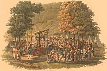
| Medieval urban herb garden |
When writers today call urban agriculture a "new movement," they are in error. But I am less interested in correcting such errors than in bringing to light a whole world of urban possibilities that existed in past times. The more we know about the past, the better we will be able to plan for the future. Look at the quotation from Winston Churchill in the top right corner of this blog: "The farther back we look, the farther ahead we can see." Or, in the words, of former Supreme Court Justice Sandra Day O'Connor, “It’s very hard to know where you’re going if you don’t know
where you’ve been.”
Here are some sources on the Aztec chinampas. The first complete and scholarly book on the city of Tenochtitlan to be published in English is now in press (Rojas 2012); it has much good information on chinampas and other features of the island city.
Ávila López, Raúl
1991 Chinampas de Iztapalapa, D.F. Colección Científica, vol. 225. Instituto Nacional de Antropología e Historia, Mexico City.
Calnek, Edward E.
1973 The Localization of the Sixteenth Century Map Called the Maguey Plan. American Antiquity 38:190-195.
2003 Tenochtitlan-Tlatelolco: The Natural History of a City / Tenochtitlan-Tlatelolco: La Historia Natural de una Ciudad. In El urbanismo en mesoamérica / Urbanism in Mesoamerica, edited by William T. Sanders, Alba Guadalupe Mastache, and Robert H. Cobean, pp. 149-202. Proyecto Urbanismo dn Mesoamérica / The Mesoamerican Urbanism Project, vol. 1. Pennsylvania State University and Instituto Nacional de Antropología e Historia, University Park and Mexico City.
Rojas, José Luis de
2012 Tenochtitlan: Capital City of the Aztec Empire. University Press of Florida, Gainesville. In press,
Smith, Michael E.
2012 The Aztecs. 3rd ed. Blackwell Publishers, Oxford.
For more context on urban agriculture see:
Boone, Christopher G. and Ali Modarres
2006 City and Environment. Temple University Press, Philadelphia.
Isendahl, Christian
2010 Greening the Ancient City: The Agro-Urban Landscapes of the Pre-Hispanic Maya. In The Urban Mind: Cultural and Environmental Dynamics, edited by Paul Sinclair, Gullög Nordquist, Frands Herschend, and Christian Isendahl, pp. 527-552. Studies in Global Archaeology, vol. 15. Department of Archaeology and Ancient History, Uppsala University, Uppsala.
Ljungkvist, John, Stephan Barthel, Göran Finnveden, and Sverker Sörlin
2010 The Urban Anthropocene: Lessons for Sustainability From the Environmental History of Constantinople. In The Urban Mind: Cultural and Environmental Dynamics, edited by Paul Sinclair, Gullög Nordquist, Frands Herschend, and Christian Isendahl, pp. 367-390. Studies in Global Archaeology, vol. 15. Department of Archaeology and Ancient History, Uppsala University, Uppsala.