Thursday, February 14, 2013

Early urbanization in Europe north of the Alps

Reconstructed fortification at Heuneburg
Greetings from Stuttgart, Germany. I have been attending a very interesting conference on Eurasian cultural developments between 800 BC and 400 BC. Today one of the conference organizers, Manuel Fernández-Götz, took me to see two early urban sites: Heuneburg and Heidengraben. They are in the state of Baden-Wurttemburg, within a couple of hours of Stuttgart by car. Heuneburg is a fascinating site and very important for understanding pre-Roman urban development in Europe north of the Alps. As we left the site was thinking I should post an entry on the site, but then I realized that Manuel could do a much better job than I could. He agreed, and his post will appear soon. So now I will just give a few impressions of the conference and the sites (and perhaps of the tasty local food), leaving the major description of Heuneburg to Manuel. Stay tuned.....

Here is some context. The old view of Iron Age Europe was that this was the setting for warlike barbarians who constantly fought one another until the Romans brought peace, civilization, and cities to the area. This view was based more on Classical authors than on archaeology. Julius Ceasar conquered many of these "barbarian" groups when he conquered Gaul in the 50s BC, and he described the larger settlements as "Oppida," meaning a large fortified settlement. Over the past century archaeologists excavated many Oppida sites, and many of these have urban functions that justify their classification as urban settlements (see my prior discussions of urban definitions:  Here  and Here ). Some of the archaeologists who contributed to this work were at the Stuttgart conference. including old hands like John Collis and Peter Wells and younger scholars like Manuel. The Oppida vary greatly, and this remains an enigmatic form of settlement.
Reconstructed gate at Heidengraben

The site of Heidengraben, which we visited today, is the largest oppida, but much of the settlement consisted of apparently empty land within a large walled enclosure. We could see some of the walls and formal gated entrances. Lost of people were out and about today, walking their dogs, cross-country skiing, and sledding on the slopes. The gate and everything else was covered with snow.


Gold jewelry from an elite burial, Heuneburg
Much more spectacular than Heidengraben is Heuneburg, which dates to the Early Iron Age, or Hallstatt period, centuries earlier. Excavations at Heuneburg long ago revealed fortifications, elite burial mounds called tumuli, imported goods and houses. But more recent work directed by Dirk Krausse (a co-organizer of the conference) has added some key attributes of social complexity and urbanism, including a very rich child burial (which suggests that wealth and status were inherited, not just acquired within an individual's lifetime); the existence of a very large "suburban" area of houses in walled compounds at the base of the fortified hill. Manuel Fernández-Götz and Dirk Krausse have written an article, now in press in the journal Antiquity, that argues for the urban status of Heuneburg. If the site was indeed an urban center, it would make it the earliest urban site north of the Alps. I agree with their evidence and interpretations, but I will let Manuel describe the site and its urban aspects in more detail in his upcoming post.

The conference explored urbanization, social complexity, political organization, and processes of individualization throughout Eurasia during the Early Iron Age (800-400 BC). It was fascinating and I learned a lot and got excited about these sites. My role was to give a talk on the concept of urbanism and how it is studied by archaeologists.

The conference participants were also given a guided tour of a fantastic museum exhibit, "The World of the Celts." This exhibit has many of the important early Iron Age finds that we saw in the slides of conferenece participants, including the gold jewelry pictured above.

One final observation at the end of an excellent trip to Stuttgart: The State of Baden-Wurttenburg really supports archaeology well. The citizens are very interested in their past, turning out in thousands to see the two museum exhibits on the Celts and visiting the sites in the region. The state cultural office has a staff of hundreds, carrying out excavations (with sophisticated and rigorous methods) mounting museum exhibits, and other activities.And one final, final observation: the food in this region is fantastic.


Here are a few sources on the Oppida, emphasizing English-language works:


Collis, John R.
1984      Oppida: Earliest Towns North of the Alps. University of Sheffield Press, Sheffield.

1997      The European Iron Age. Routledge, London.

Fichtl, Stephan
2005      La ville celtique: Les oppida de 150 avant J.-C. à 15 après J.-C. Revised ed. Errance, Paris.

Pitts, Martin
2010      Re-Thinking the Southern British Oppida: Networks, Kingdoms and Material Culture. European Journal of Archaeology 13:32-63.

Wells, Peter
2011      The Iron Age. In European Prehistory: A Survey, edited by Sarunas Milisauskas, pp. 405-460. 2nd ed. Springer, New York.

Woolf, Greg D.
1993      Rethinking the Oppida. Oxford Journal of Archaeology 12:223-234.


Sunday, January 13, 2013

"Les Misérables" and urban planning in Paris

Death of Eponine, from the novel
Cindy and I just saw the movie, "Les Misérables," which is outstanding. It provides a good illustration of one of the reasons why Paris was redesigned in the 1860s, when narrow twisting streets were replaced by wide boulevards. Baron Haussmann was the designer and builder in charge of that project, and in a previous post I talk about his work and how it produced the city plan as we know it today.

Urban historians have shown that one of the reasons for the redesign of Paris was to make it harder for protesters to seize the streets and block them with barricades, as in the final part of Les Misérables. The death of Eponine, at the barricade, was illustrated in the original novel, and it is a big scene in the play and movie. The uprising in Victor Hugo's novel took place in 1832 (the novelist experienced that event first hand). There had been an earlier protest in 1830, and then the most successful of these contentious events was the 1848 revolution.
Death of Eponine (Samanta Barks), from the movie

So, how did Haussmann's new plan of Paris help reduce protest in the streets? First of all, the new wide, straight streets made it harder for protesters to block off neighborhoods with barricades. Also, the wide boulevards made it easier for troops to move from one area to another quickly in case of a rebellion. The railway stations, one of the most important kinds of transportation infrastructure in the 19th century, were the origin points of many of the boulevards. This allowed troops to be moved into place efficiently by train and then dispatched to problem areas.

The urban histories (see the bibliography in my original post) note that the 1871 rebellion (the "Paris Commune") was quickly put down, in part because of the military advantages of Haussmann's redesign. But the 1832 uprising of the students and immigrants (sometimes called the "June Rebellion") was also quashed pretty quickly, as in the novel.

The movie barricade


See my earlier post for more on the redesign of Paris. And who knew that Russell Crowe could sing?

Wednesday, December 26, 2012

Old Bluffton: A Ghost Town Rises from the Lake


Old Bluffton (from Texas Observer)

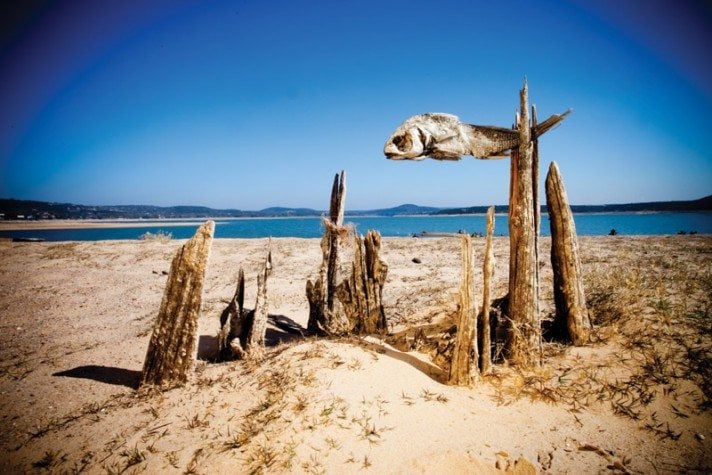
Greeting from Lake Buchanan, Texas! We are spending Christmas with Cindy’s parents, Jim and Maxine Heath of Buchanan Dam, Texas. Their house sits on the (sometime) shore of Lake Buchanan, formed when the Little Colorado River was dammed in the 1930s. I say “sometime shore” because the lake level has been down considerably for several years due to drought. Right now, the lake is 25-30 feet down, and the shore is a quarter mile or more below their yard. Previously, they could launch their sailboat directly from their property.

House foundation
The lowering lake level brought up the remains of the ghost town of Bluffton, submerged when the lake was formed. You have to travel nearly two miles on the old lakebed to reach the ruins. I made a brief attempt last February; I was dog-and-house-sitting for my in-laws while writing my current book. But the descent from the modern road to the lake-bed seemed too steep and difficult for my 2-wheel-drive Ford Ranger (my daughter April teases me about my wimpy truck-- she drives a big F-150). With Jim Heath’s four-wheel drive Chevy Suburban, however, it was not hard to get out to Old Bluffton. We were returning from visiting the Fall Creek Winery a few miles to the north (excellent Texas wines!).

Bluffton cemetery being moved before the flood
Bluffton was founded by the David family, who moved from Arkansas in 1883. The town burned down at one point and was rebuilt some distance to the south. Residents harvested pecans and grew corn and cotton. When construction began on the dam, the Lower Colorado River Authority bought up people's properties. Some residents moved to the new town of Bluffton nearby and others left the area. Engineers in 1937 calculated that it would take four years for the lake to fill in behind the new dam, but heavy rains shortened that time to a few months. All but one grave from the cemetery were moved prior to the flood.
House foundation

The ruins today are not very spectacular. I only had a short period to see the site and take a few photos. Visitors to the site seem to be aware they are not supposed to remove artifacts, and people have piled up broken glass, potsherds, and rusty iron objects on top of the cement and stone remains at the site.


Artifacts piled on a cement slab
Artifacts piled on a building stone


Not much is left of old Bluffton. The ruins are considerably sparser and in much poorer condition than the many old mining towns and other ghost towns that litter my state of Arizona. But the fact that we know something of the history of the town and the names of its residents gives this site a rare immediacy. The glass jars and rusty nails seem familiar - they look like they could be five years old, not 75 or more. 
My father-in-law and I look at an old well
Another way to visit old Bluffton is with the Vanishing Texas River Cruise. They sometimes stop at Old Bluffton (I've taken their river tour of Canyon of the Eagles; it was great). Or you can find instructions on reaching the site on a number of websites. For more information, check out the website describing a field trip to the site by the Llano Uplift Archaeological Society. They have nice photos and a sketch map. (I attended one of their monthly meetings last February - a nice group of archaeologists and knowledgeable amateurs.) There are articles about Old Bluffton in the Texas Observer, focusing on the history of the town, and on the website, Texas Escapes.

Friday, December 14, 2012

How to compare cities, using digital methods


 I am writing from the city of Leeds in Yorkshire, where a very nice conference on comparative urbanism just finished up. This is a quick post about the session, and maybe I will write something in more detail at a later time. The session was called “ACUMEN: Assembly for Comparative Urbanism and the Material Environment." with the subtitle: “Digital methodologies for social research for processes of urban landscape development.” The conference was the brainchild of Benjamin Vis, an archaeologist who is now in the Ph.D. program in Geography at the University of Leeds. It was held at Haley’s Hotel in Leeds, a comfortable place to talk about urbanism with a bunch of fascinating people (although they aren't going to win any awards for their internet service - I may or may not get this thing posted before I leave town!). There is some information at the pre-conference website.

The ACUMEN conference brought together people working on various approaches to comparative urbanism and using various current methods, in particular historical/archaeological GIS analysis. There were geographers, historians, archaeologists, architects, and some folks difficult to classify. In addition to presentations by established scholars, the conference include a “PechaKucha,” an event that was new to me. A group of people, mostly students, gave very brief presentations of their research, limited to 20 slides and six minutes.

I gave the opening talk, and a summing-up at the end. Benjamin called me the conference “Ambassador,” but I am still not sure what that meant. It was fascinating to hear about a bunch of creative and important urban research projects. My approach to comparative urbanism, which should be clear if you have followed this blog, has been to start with a theme that cuts across many periods and regions, especially ancient and modern cities. Themes I’ve written about (here and in articles) include informal settlements, urban sustainability, urban sprawl, neighborhoods, and gated communities. So far, my comparisons have not been done in great detail, except perhaps for the theme of neighborhoods.

Most of the participants in the ACUMEN conference used one or both of two alternative approaches to analysis and comparison. The first is methodological. GIS analysis is rapidly becoming the standard method in research on urban form (and other topics) in archaeology, geography, and history. We heard about some great urban-GIS analyses, particularly the historical mapping of Paris by Eric Grasso and colleagues, and studies of medieval British towns by Keith Lilley (I apologize for this hasty posting, without links; I will try to get them done, but it may have to wait till I am back in Arizona). GIS is a method to provide a standardization of data for comparing cities.

The second method to comparison discussed at this conference is theory- or approach-driven. The two main examples here were space syntax and urban morphology. Space syntax, a method of analyzing the uses of and access to spaces in buildings and cities, has become increasingly popular in some archaeological traditions. It is not a universal method, because its applications rely on complex room arrangements within buildings, or street patterns in cities. In my own case, Aztec houses have one room and Aztec cities do not have streets. But for the western urban tradition (plus a few examples from other traditions), space syntax is very useful. Sam Griffiths, a space syntax expert at the University College London (center of the space syntax movement), gave an interesting talk on the methods, its uses, and its limitations. A number of the other participants are using, or have used, space syntax previously. (links will be provided……).

Urban morphology is more of a method or approach than a theory. See the journal Urban Morphology for examples. This approach fits well with GIS (as in Keith Lilley’s work) and with space syntax. While only a couple of the participants work within the urban morphology approach, most of the work featured at the conference focused on urban morphology or form in a broader sense.

This was a great session, and we all left with new ideas and inspiration to try to keep the cross-disciplinary dialogue going somehow. Benjamin Vis will probably be setting up a website for ACUMEN before long, and I will talk more about this in the future.

I also got to spend part of a day in York, looking at Roman, Viking, and medieval remains. And it was great sampling the local ales.

Friday, November 23, 2012

"Connecting Past and Present:" Cities and global environmental change

"Connecting Past and Present: Lessons in Urbanization and the Environment." This is the title of a special section of three articles in the new issue of UGEC-Viewpoints. This newsletter/magazine is put out by the project, "Urbanization and Global Environmental Change," which in turn is part of a larger research network called "International Human Dimensions Programme on Global Environmental Change."

These three papers lay out some of the basic arguments for why ancient cities might be relevant for understanding contemporary urbanization and its environmental impact today. The phrase "might be relevant" is important; I will return to it below.

The section starts off with my paper, "The Role of Ancient Cities in Research on Contemporary Urbanization."
I ask, "Why should researchers in this area pay attention to ancient cities?" and I suggest two reasons. First, the long-term perspective of archaeological data lets us look at cities that rose and fell over period of centuries and millennia. Second, ancient cities add to our sample of urban possibilities, allowing a broader perspective on the diverse ways people have designed, built, and lived in cities over the ages. These are things I've discussed quite a bit in this blog. I go on to describe our transdisciplinary urban project at Arizona State University, and then discuss two topics: low-density tropical urbanism (the theme of the other 2 papers in the special section) and research on ancient urban sustainability (drawing on my paper, Smith 2010).

We were asked by UGEC Viewpoints to say something about the policy implications of research, so I give a few opinions on that matter. Briefly, planners and policy makers don't care about ancient cities, and they are not going to look at our archaeological findings to provide clues or guidance for contemporary urban issues. But enlightened planners and policy makers do care about research on cities and urbanism in general, and if archaeologists can provide data to broaden that more general body of research, then our results might have an indirect effect on policy or planning.

The second paper in the UGEC Viewpoints special section is: Scarborough, Vernon L., Arlen F. Chase and Diane Z. Chase  (2012)  Low-Density Urbanism, Sustainability, and IHOPE-Maya: Can the Past Provide More than History?
They talk about the project IHOPE-Maya, which involves a number of specialists in Maya archaeology and some formal modelers who are examining Classic Maya society in terms of concept or resilience and sustainability. This is an exciting endeavor. The Maya had fascinating cities and distinctive urban social and cultural expressions, but most fieldwork has been very particularistic. That is, archaeologists excavate Maya sites to learn about Maya sites, without much comparative analysis and without much concern with using their results to shed light on broader questions. The authors state,

"With respect to the ancient Maya, determining the degree to which they successfully altered their environs – or regionally damaged it – within the constraints of their technologies and innovations has great potential for assessing present-day societal adaptations." (p. 20)

This is an important new direction for Maya studies. I must admit that I find some of the article puzzling. I am not sure what the authors mean by this statement:

"Perhaps our Western technologies are now finally poised to revisit a notion of urbanism reclaimed from the past." (p.21)

They go on to make a comparison between Maya and modern urbanism that seems very abstract:

"the internet and the cultivation of market-driven co-operatives based in rural settings are the loose equivalent of the roads and calendars (the internet) and resource-specialized communities (the cooperatives) of the Maya."  (p.22)

Tikal, Guatemala, one of the largest of the Classic Maya cities
In the third paper, Christian Isendahl attacks the problem of "urban essentialism" ("Investigating Urban Experiences, Deconstructing Urban Essentialism"). Urban essentialism is one of the perspectives that holds back our understanding of general patterns of modern and ancient urbanism. Isendahl shows,

"how deep-rooted the modernist perception of urban essentialism has been over the last century, dominating and streamlining how we tend to think about urbanism as a largely uniform type of social formation, even in the pre-modern past."  (p.27)

In other words, many people--both the public and scholars--have this idea that there is a single kind of urbanism and a single kind of city, when in fact there is much variation around the world and through history. Isendahl focuses on the topic of urban agriculture, and how it goes against the standard western view that rural and urban and completely different and opposed settings:

"The body of evidence indicates that agricultural production cannot comfortably be regarded as ‘the antithesis of the city’ — as common essentialist-flavored understandings of urbanity seem to suggest — but is in many cases a fully integrated urban activity, viewed at the long-term and global scales." (p.28)

Above, I use the phrase "might be relevant" for the role of ancient cites in contributing to our knowledge of general patterns of urbanization today. Here is the problem. While archaeologists have lots of data on issues of cities and the environment, resilience, social patterns, and so on, we have yet to analyze those data in a framework that can be used by scholars working on contemporary urbanism. Right now, about all we can do is bring up some isolated examples. So while there are some urban scholars out there who think that past cities are relevant to contemporary concerns, archaeologists have yet to get our act together to produce reliable scientific findings that those scholars could use. This is the basic theme of Smith (2010). For a broader statement of the idea that archaeological can contribute to wider social-science research, see Smith et al. (2012).

For more discussion of these issues, look over my past posts, and check out some of these papers:

Barthel, Stephan and Christian Isendahl
2012    Urban Gardens, Agriculture, and Water Management: Sources of Resilience for Long-Term Food Security in Cities. Ecological Economics ( in press; published online).

Costanza, Robert, Sander van der Leeuw, Kathy Hibbard, Steve Aulenbach, Simon Brewer, Michael Burek, Sarah Cornell, Carole Crumley, John Dearing, Carl Folke, Lisa Graumlich, Michelle Hegmon, Scott Heckbert, Stephen T. Jackson, Ida Kubiszewski, Vernon Scarborough, Paul Sinclair, Sverker Sörlin and Will Steffen  (2012)  Developing an Integrated History and future of People on Earth (IHOPE). Current Opinion in Environmental Sustainability 4(1):106-114.

Isendahl, Christian  2012    Investigating Urban Experiences, Deconstructing Urban Essentialism. UGEC Viewpoints (Urbanization and Global Environmental Change) 8:25-28.

Isendahl, Christian and Michael E. Smith 2013    Sustainable Agrarian Urbanism: The Low-Density Cities of the Mayas and Aztecs. Cities 30 (in press; published online).

Scarborough, Vernon L., Arlen F. Chase and Diane Z. Chase  (2012)  Low-Density Urbanism, Sustainability, and IHOPE-Maya: Can the Past Provice More than History. UGEC Viewpoints (Urbanization and Global Environmental Change) 8:20-24.

Scarborough, Vernon L., Nicholas P. Dunning, Kenneth B. Tankersley, Christopher Carr, Eric Weaver, Liwy Grazioso, Brian Lane, John G. Jones, Palma Buttles, Fred Valdez and David L. Lentz  (2012)  Water and sustainable land use at the ancient tropical city of Tikal, Guatemala. Proceedings of the National Academy of Sciences 109:12408-12413.

Smith, Michael E.  2010    Sprawl, Squatters, and Sustainable Cities: Can Archaeological Data Shed Light on Modern Urban Issues? Cambridge Archaeological Journal 20:229-253.

2012    The Role of Ancient Cities in Research on Contemporary Urbanization. UGEC Viewpoints (Urbanization and Global Environmental Change) 8:15-19.

Smith, Michael E., Gary M. Feinman, Robert D. Drennan, Timothy Earle, and Ian Morris  2012    Archaeology as a Social Science. Proceedings of the National Academy of Sciences 109:7617-7621.


Monday, November 5, 2012

Cities, semi-urban places, and definitions

I periodically think about how we define terms like city and urban. There is no final and ultimate definition of terms like this. Definitions are tools. They help us solve intellectual problems and they help us understand the world. A definition that works in one context may not be helpful in another.

As I have discussed here previously (Original post on definitions), there are two major approaches to defining cities and urbanism: the demographic and the functional. Louis Wirth's influential demographic definition uses four features to define cities: permanence, high population, high density, and social diversity or complexity. The alternative functional approach says that any settlement that fulfills urban functions for a hinterland can be called urban. An urban function is an activity or institution in a settlement whose effects extend beyond the settlement. See the original post for more discussion and some references.

Role of 3 factors in definitions of city and urban
In a later post, I discuss how these and other definitions of city and urban vary in the importance they give to three factors: population, social complexity/ diversity, and influence or function. The other day I made up a diagram to illustrate this point. It is a kind of "triangular graph" that shows the relative importance of these three variables (at the 3 points). The two ellipses show how the major urban definitions rely on these three factors. Wirth's (demographic) definition relies entirely on population and complexity, so it lies far away from the functional point on the graph. The functional definition runs from the functional corner up toward the complexity corner. The reason for extending the area toward the top is that urban functions almost always require social complexity in the urban center. For example, a political capital typically requires different occupations and often different social class composition, if only to fulfill the basic operations of the government.

Camp meeting
In our attempts to understand complex social phenomena (like urbanism), sometimes examples at the extremes shed light on broader patterns. For this reason, in my class on ancient cities I always cover case studies whose urban status is the subject of great debate. The European Iron Age oppida is one example (functionally urban, but not demographically), or Chaco Canyon (just about nobody besides Steve Lekson considers this settlement to be urban). These cases help students see just what urbanism is all about.

In a paper I am now revising, my coauthors and I follow a parallel logic. In order to support a larger argument that neighborhoods are universal in human settlements, we examine a group of "semi-urban settlements" to see if they have neighborhoods. (the answer is yes in all cases except disaster camps). I talk about this study in a previous post. Our paper got a judgment of "revise and resubmit" from a journal, and one complaint of the reviewers was that we didn't define the term "semi-urban" very well. So I've been thinking about how these settlements relate to the standard definitions of urbanism. I made up a second triangular graph to help me understand these settlements.
Two categories of semi-urban settlement in the definition triangle

Actually, there are two very different kinds of semi-urban settlements, each with different dynamics of change (and different neighborhood processes as well). The first category I call "voluntary camps." These are things like religious camp revival sites, festival sites (like Burning Man), RV camps, and the the various urban "Occupy" campsites from last year. I am fascinated by these settlements, and I am convinced that they can teach us much about cities and urban dynamics. In terms of defining this category, the main traits are that these are limited-purpose settlements, rapidly settled, temporary, and voluntary. On the triangular graph they lie close to the Population corner. They do not have urban functions, and they may or may not have social diversity.

Japanese-American internment camp
The second group of settlements classified as "semi-urban" are those that planner Kevin Lynch called "the city as practical machine." I've talked about these previously. This category includes things like military camps, company towns, internment camps, refugee camps and disaster camps. The key feature of these sites is their top-down design and establishment in order to fulfill a specific activity within the larger society. Their specialized activity, whether confinement, economic exploitation, or something else, can be considered an urban function, so I place these settlements at the function/influence corner of the graph.

So, it turns out what one reason we had trouble coming up with a nice succinct definition of "semi-urban settlement" is that this category actually includes two very different types of settlement. But both are urban-like in some ways but not others, and few would be classified as "cities" or "urban settlements" on their own. But they are all part of the Wide Urban World, and they can all teach us much about cities and urban processes.

Thursday, November 1, 2012

The "mysterious" ruins of Machu Picchu


Why do the media insist on claiming that all ancient cities were "mysterious"? Last night I watched a TV program on PBS called "The Ghosts of Machu Picchu." This was a "Nova - National Geographic Special." Most television shows about ancient cities are full of nonsense and I generally avoid them. But with one or two exceptions, the PBS series Nova does a good job explaining archaeology and ancient topics like cities. They usually take an objective, scientific viewpoint. Most research shown on Nova is driven by questions and problems that scientists solve with objective methods. National Geographic television programs, on the other hand, usually take a sensationalist approach that combines good research and known facts with an overblown dramatic perspective. For NGS, research is driven more by dramatic discoveries made by intrepid explorers than by testing models based on research questions. For NGS, ancient ruins are inherently mysterious.

"The Ghosts of Machu Picchu," as might be expected, combines these two approaches. A number of major experts were interviewed and shown at the site and in the lab. These individual segments were fine. I particularly liked John Verano talking about the skeletal material and Kenneth Wright on the fascinating hydrology of the site. Seeing Fernando Astete (the archaeologist in charge of the site) at Machu Picchu and nearby sites was great. But I got really tired of the constant barrage of statements by the narrator (NOT by the experts!) about how mysterious the site is. A few examples:

  • Machu Picchu is "a ruin that defies explanation."
  • "Who were the mysterious people who built it?"
  • "How could a people without iron tools or the wheel have produced such a masterpiece?"
  • The site is "beautiful and baffling"
  • Scholars have "no written clues" about the site. [not true].

Yale explorer Hiram Bingham "discovered" Machu Picchu in 1911. He was mystified at this towering complex site on top of a mountain, but his research team made a number of errors and as a result the site got the "mysterious" label. Why was this site built? Who built it? Why is is to strange? Given the scanty knowledge available before 1990, perhaps the "mysterious" label made sense. But then John Rowe (1990) located a Spanish early colonial document that basically explained what Machu Piccu was: an estate of the Inca emperor Pachakuti. The Inca kings built a series of royal retreats down the Urubamba Valley from their capital, Cuzco, and this site was built for Pachakuti.

These Inca estates are a kind of settlement different from regular cities that were administrative centers of the empire. The diagram (from Susan Niles 1993) shows how this was organized. Sites like Huanuca Pampa were political capitals, and sites like Machu Piccho, Ollantaytambo, and others, were the royal estates. These were attached directly to the kings, rather than run by the empire. Niles (1993) explains this well.

So there is little that is mysterious or baffling about the site, any more than one can say that ANY ancient cities is mysterious only because we have limited evidence. The only expert in the show who even suggested that there was a "mystery" about Machu Picchu was Johan Reinhard, an explorer/archaeologists who works for the National Geographic Society. The show did not mention Rowe's insights, although they did finally mention the document.

Major segments of the modern media seem to feel they have to claim that ancient cities are "mysterious" in order for people to pay attention to their stories or shows. But rather than building up false mysteries about sites like Machu Picchu, wouldn't it be better if they played up the truly interesting and important things about these cities? In its hybrid approach, "Ghosts of Machu Picchu" did this to some extent. The hydrology is incredibly fascinating. Major efforts were put into channeling water both to, and away from, the terraces at the site. This was an engineering marvel. The show never went anywhere with its question, "How could a people without iron tools or the wheel have produced such a masterpiece?" On one level, this question is silly. The Inca clearly did build the site without iron or the wheel. Many other ancient civilizations did similar things. But on another level, this is a great question, one that could provide an entry into Inca architecture and construction. But the show only talked a bit about that topic, which was not a major focus.

Machu Picchu has lots of lessons for our understanding of processes of urbanism around the world. It shows how an urban society can have two very different types of state-built cities, each for different purposes. It shows how the urban expressions of royalty could be different from the urban expressions of imperial administration. It shows the nature of limited-purpose cities. It shows how standard patterns of stoneworking, buildings, and urban planning concepts were adapted to the individual particularities of a spectacular and precarious setting. (I was waiting for a comparison of the layout of Machu Picchu to that of Patallakta, the agricultural town shown in the show. Such a comparison is very revealing of Inca urban planning practices). Machu Picchu shows how urbanism looks in a society that has a noncommercial economy (no money, no markets, no merchants; this was a command economy). This site has many lessons for the Wide Urban World, only a few of which were touched on in "Ghosts of Machu Picchu." These are interesting topics for research, but they aren't "mysteries."

In addition to Niles and Rowe, two recent monographs have good information about Machu Picchu:

Burger, Richard L. and Lucy C. Salazar (editors)
2003    The 1912 Yale Peruvian Scientific Expedition Collections from Machu Picchu: Human and Animal Remains. Yale University Publications in Anthropology. Yale University, New Haven.

Niles, Susan
1993    The Provinces in the Heartland: Stylistic Variation and Architectural Innovation Near Inca Cuzco. In Provincial Inca:  Archaeological and Ethnohistorical Assessment of the Impact of the Inca State, edited by Michael A. Malpass, pp. 145-176. University of Iowa Press, Iowa City.

Reinhard, Johan
2007    Machu Picchu: Exploring an Ancient Sacred Center. Monograph. Cotsen Institute of Archaeology, UCLA, Los Angeles.

Rowe, John H.
1990    Machu Picchu en la luz de documentos del siglo XVI. Histórica (Lima) 14(1):139-154.


One more thing: If you ever wondered about that rope bridge in "Indiana Jones and the Temple of Doom," it is an Inca bridge, built for the film by the descendants of the Incas, who still use these bridges today.